Connecting routes from Velenje to K1/SPP1, K40 and E7
Connecting route to SPP1 and K40 from Velenje, past the home on Paški Kozjak to the alpine hut: Koča na Pesku (Rogla).
Since we are adding a GPX track that will lead you to your destination, we are only adding a picture and text description of the checkpoints where a little more attention is needed, or where we suggest you make a stop.
Option 1
Velenje – Paka pri Velenju – hut on Paški Kozjak (the shortest route, with the least elevation gain and loss, suitable even for those with less orientation experience and, most importantly, this route allows the most entry and exit points).
DAY 1
As a starting point, we suggest one of the parking lots between two shopping centers between the hamlets of Šalek and Selo on the edge of Velenje. There, cross the regional road and also the Paka River at the pedestrian crossing.
The path along the Paka River follows the route of the abandoned Velenje – Slovenj Gradec railway line. After about 4 km, when you see the former elementary school on the left, be prepared to turn right off the path.
You will turn right onto the asphalt road (which turns off the regional road next to the aforementioned school) along which you will climb above Quarry Paka. A yellow sign will warn you not to turn into it.
You can follow the road all the way to the Paški Kozjak Lodge, but we suggest that you choose to climb along the marked path, which intersects the asphalt road on most of the serpentines on the way to the aforementioned lodge.
Please note that at the time of writing this route description, the lodge is closed until further notice! Any changes will first be visible on the website of the association that manages it:
After the opening, the Planinski dom will be a great place to end your day’s tour. For that, we suggest the following route: on the part of the route where the (snowy) forest begins in the photo Ad k 3, you can follow the asphalt path and first climb to the top of Špik via the western ridge and descend along the south-eastern ridge to the church of St. Jošt. Then return to the aforementioned lodge.
You can find the control stamps in the wooden canopy opposite the lodge on Paški Kozjak.
From the Planinski dom, head further onto the macadam path, from which a forest path branches off to the left after a few hundred meters, along which you can go to the church of St. Jošt.
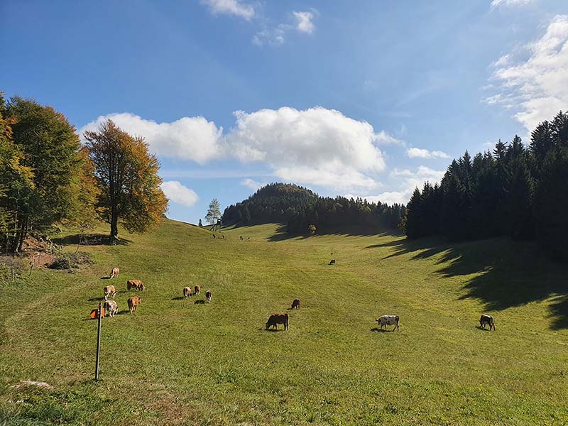
At the parking lot by the aforementioned church, you can turn right into the forest towards Ostrica or climb to the nearby Špik, which, unlike the highest peak of Paški Kozjak called Basališče, is a very scenic spot. From there you will enjoy wonderful views of the Šaleška Valley, all the way to the Kamnik-Savinja Alps and the peaks of nearby Koroška. If you do not visit this peak, you can also stop at the beautiful grassy plain of Ostrica, where there is a real Indian tent.
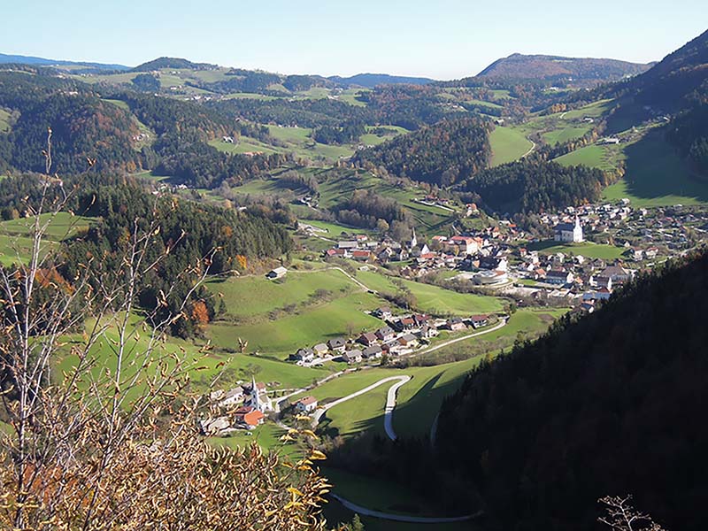
For the descent from Basališče, we suggest that you first descend to the Javorje hunting lodge, then head northeast to reach the mountain road. Then pass the Verzelak and Strmečnik farms into the valley to the center of Vitanje. Before descending, stop at the viewpoint at Strmečka Peča.
SPECIAL WARNING: On the latter section and on the path from the church of St. Jošt to Ostrica, the path is exposed and even precipitous in certain sections, so special caution is required there, even though it is not a demanding path. On all other paths, walking can be more relaxed.
The last section of the route is described in more detailly described at following link …
DAY 2
We recommend that you end the previous day’s tour in Vitanje and that you find time in this town to visit the Herman Potočnik Noordung Space Technology Center. More at: Space center Nordung and Vitanje.si
Since we strongly support public transport to the starting points for mountain tours, we would like to add the following option.
Option 2: from the bus station in Velenje
After leaving the bus station, cross Šaleška cesta and head east. After 750 m, before the tunnel above which is Šaleški Castle, you will turn left and from the church of St. Andrew, via Zgornji Šalek, Radojč, Ramšakov vrh to the Paški Kozjak hut, a well-marked mountain trail will lead you.
You can download the GPX track for the routes described above from the following link …
Authors of the photos, GPX tracks, and route description: M.Sc. UROŠ IVANČIČ, AAS/PZS guide and Mojca Tisovec, AAS/PZS guide,
Author of the photo of the view of Vitanje: Franc Maršnjak, AAS/PZS guide.
And a few more photos that are not added to the above-described title with the GPX track:
Ad. to point 1: Where to cross the regional road and the Paka River
Ad. to point 2: Before the first turn to the right, you will see the former elementary school
Ad. to point 3: When you climb above the Paka quarry, a view of the peak of Špik opens up, which you can conquer along the left ridge. The Paški Kozjak lodge is on the right saddle, lower than the peak.
Ad. to point 4. What you will be able to see from in front of the Paški Kozjak lodge is presented in the video Invitation to the Velenje Mountain World, which you can view at:
Ad. to point 5: You can find the stamps in the wooden canopy opposite the Paški Kozjak hut.
Ad. to point 6: Parking lot in front of the church of St. Jošt. Possible routes: Špik, Ostrica and Dom na Paškem Kozjaku. What you will be able to see from in front of Dom na Paškem Kozjaku is presented in the video Invitation to the Velenje mountain world, which you can view at: https://youtu.be/_hC32c60gFc
.
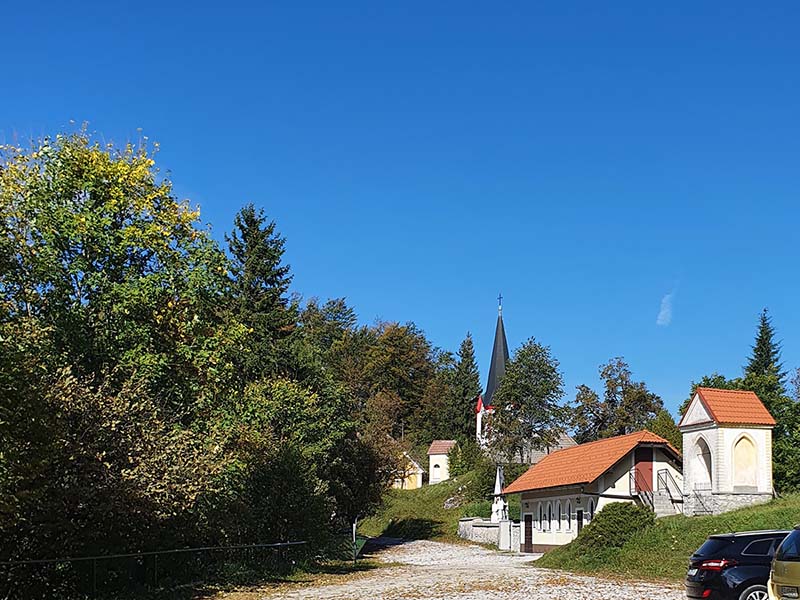
Ad. 7: The beautiful Ostrica grassy plain
Ad. 8: View of Vitanje and the last part of the trail from the viewpoint at Strmečka Peča. (photo by: Franc Maršnjak)
Ad. to point 9: Herman Potočnik Noordung Space Technologies Center, Vitanje